The Environmental Section works with all of GLIFWC's sections and staff to investigate threats to resources from many different sources. The five major areas in which the section specializes are climate change, nibi (water), contaminants, metallic mining, and oil pipelines.
The Section has contributed to the development of climate vulnerability assessments for beings (species) in the Ceded Territories, planning for adaptation to climate change, and seed collection and storage. The GLIFWC contaminants program has focused on mercury and PFAS contamination in fish and the risks of herbicide applications to aquatic organisms. Establishing baseline water quality, monitoring water flows downstream of mining projects, and characterizing manoomin (wild rice) waters are key to GLIFWC's efforts to protect the quality of nibi. The Section reviews mining and pipeline projects in the Ceded Territories, submits technical comments, and assists member tribes in understanding the potential impacts of mineral development and pipeline construction/operation. The Section's efforts include collecting, preserving, and incorporating Traditional Ecological Knowledge (TEK) into its work. A satellite office allows GLIFWC to maintain contact with state agency staff and faculty at the University of Wisconsin-Madison as well as access to a wide variety of research, hardware, and software resources.

The GLIFWC Environmental Section participates in a number of projects related to chemical contamination of fish, wildlife, and the environment of the Ceded Territories. GLIFWC works closely with other GLIFWC sections (e.g. Wildlife and Inland Fisheries) as well as many tribal, state, and federal agencies to characterize and respond to contaminant threats to treaty resources. GLIFWC will continue to become involved in new projects as directed by our member tribes. For more information, see the Contaminants page.
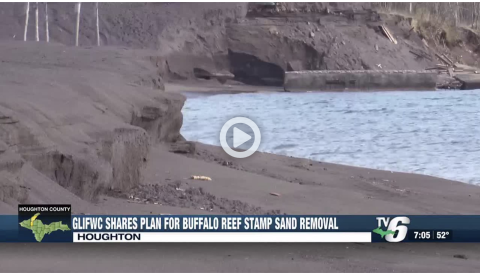
GLIFWC requests support for Buffalo Reef stamp sand removal.

Climate change is altering our environment, shifting and disrupting plant and animal habitats and affecting how Anishinaabeg hunt, fish, and gather. GLIFWC’s Climate Change Program is working on several projects to characterize the extent of these changes in the Ceded Territories in order to help its member tribes maintain their way of life. For more information, see the Climate Change Program page.
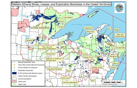
A primary focus of the Environmental Section staff has been to evaluate the environmental threats from mine projects and mineral exploration from a tribal perspective. Those activities can impact natural resources across the Ceded Territories.

Environmental Section staff participate in the environmental review of proposed mines by interacting with federal and state regulatory agencies and advocating for thorough analyses of the environmental impacts of the proposed mines. The Section also conducts independent data gathering and analysis to identify and describe possible mine related impacts to the environment. Impacts of existing mines and past mining activity on the environment are also investigated and the section keeps member tribes informed on issues that may affect the health and availability of treaty resources and the ecosystems on which they depend. Mining related documents, analysis, and comments are available here.
Following the failure of a $50 million grant from the Michigan Economic Development Corporation (MEDC) to Highland Copper to make it into the state budget for the proposed Copperwood Mine, site development has slowed but continues to move ahead.
The almost two-decade long effort to address contamination from mine tailings along the eastern shore of the Keweenaw Peninsula takes a major step forward with the release of the Final Alternatives Analysis report.
Buffalo Reef is a natural cobble feature in Lake Superior, located just off the eastern edge of the Keweenaw Peninsula in the U.P of Michigan. The reef has historically maintained invaluable spawning habitat for fish species such as lake trout and lake whitefish.
The Transporation and Resource Extraction Committee (TREC) is a subgroup of the Lake Superior Partnership Working Group. GLIFWC staff work in the partnership to protect and restore the Lake Superior ecosystem through collective and coordinated action.

The Environmental Section works to protect the health of nibi in the Ceded Territories and the beings who depend on those waters.
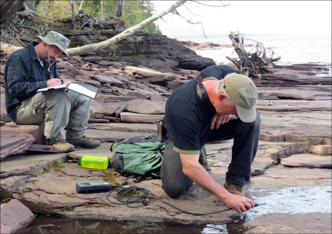
While there are many factors that impact the health of nibi, section staff focus primarily on specific contaminant such as mercury, PFAS, and herbicide applications to open waters. A major effort has been to monitor and predict the impacts of mining, oil pipelines on water quality. Since 2008 staff have collected water quality samples to establish baseline water quality and detect impacts from mining and other industrial development. GLIFWC works closely with federal agencies such as the Unites States Geological Survey to monitor water quality and quantity in rivers of the Ceded Territory.
USGS Stream Gages supported by GLIFWC
Flow | Flow and Chemistry | Flow and Chemistry |
Flow and Chemistry Upstream of Humboldt Mill. | Chemistry Downstream of Humboldt Mill | Flow and Chemistry |
Flow and Chemistry | Flow and Chemistry | Flow and Chemistry |
This interactive map is intended to demonstrate the status of an ongoing project to identify important habitat in the Lake Superior region. Data are summarized from existing information submitted to the Lake Superior Partnership Working Group.
The Bend copper-gold massive sulfide deposit is owned by the federal government and located in the 1837 Ceded Territories.The deposit is in a watershed abundant in treaty resources, and twelve stream miles down the Yellow River is the popular manoomin harvesting destination Chequamegon
GLIFWC has worked to characterize the past, present, and potential future impacts of pipelines that cross the ceded territories with a particular focus on Line 5. This focus is intended to develop information to inform regulatory agency decisions on the potential renewal of permits for existing pipelines and environmental reviews for proposed new pipelines.
A Decision Support Analysis of Line 5 Crude Oil Pipeline Within the GLIFWC Ceded Territories and the Chequamegon-Nicolet National Forest.


